How Many People are on that Beach? NOAA Economists Release Guide to Counting Coastal Recreators
May 24, 2017
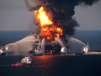
NOAA’s Office of Response and Restoration published a new guide for any organization interested in measuring recreational use at shoreline areas, fishing sites, and boat ramps affected by an oil spill. The resource titled, Best Practices for Collecting Onsite Data to Assess Recreational Use Impacts from an Oil Spill, builds off the processes and lessons learned from our experience conducting the natural resource damage assessment for the Deepwater Horizon oil spill.
While assessing lost recreational use opportunities is an integral component of most natural resource damage assessments, the Deepwater Horizon incident provided an unprecedented challenge to develop procedures for a vast area, and for an extended period. Shortly after the spill, NOAA, in coordination with other state and federal trustees, implemented a study that used aerial overflights and hundreds of field interviewers, photo counters, data entry staff, programmers, economists, survey research experts, and statisticians. The scientists designed the study to be rigorous, comprehensive, and technically defensible. The associated data collection process formed the basis of the new guide. If followed, this guide can be used by any public agency or private organization to generate reliable and defensible estimates of recreational use that can inform policy, planning, or natural resource damage assessment case decisions.
The new resource, also known as the Onsite Data Collection Manual, is available on the Damage Assessment, Remediation, and Restoration Program website and includes an interview data entry template.


